Rivers & Backwaters
The five rivers that made Kundapura, the Panchagangavalli system.
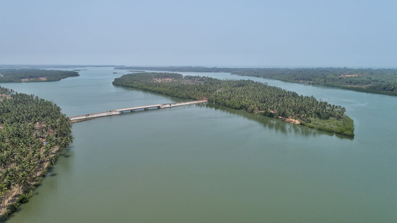
If one feature defines Kundapura, it is water. The town stands on the Panchagangavalli ("five-river waters"), a river system named for five converging streams, the Souparnika, Varahi (Halady), Kedaka, Chakra and Kubja, which rise in the Western Ghats and join near Gangolli to form a broad estuarine backwater before entering the Arabian Sea. The rivers carry torrential monsoon flows (annual rainfall here runs to roughly 4,800–5,000 mm) and taper to gentle, tidal channels in the dry months.
 Panchagangavalli
The five rivers
Each of the five Panchagangavalli rivers has a distinct course down from the Ghats, and all interconnect through wetlands and distributaries, especially at high tide, when the whole north-Kundapura lagoon becomes one united brackish waterbody.
| River | Source | Course & notes |
|---|---|---|
| Souparnika | Western Ghats near Kollur (Mookambika Hills) | Flows SW through forest and farmland past the Kollur temple; approaches the estuary from the south-east. Sacred to pilgrims. |
| Varahi (Halady) | Western Ghats near Agumbe | The largest; dammed for the 460 MW Varahi hydro-electric project and the main municipal water source. Meets the estuary from the east. |
| Chakra | Ghats near Kollur / Kodachadri foothills | Flows west through farmland; enters the estuary from the south. |
| Kedaka | Coastal Ghats (Kollur region) | A smaller stream joining the others near Kodi / Kundapura. |
| Kubja | Kodi / Mattu area east of Kundapura | Flows west past the Chitrapura Durga temple; Uppinakudru sits in its mangrove delta. Approaches from the north. |
These channels converge in the Gangolli backwater north of town, where the historic port of Gangolli sits at the mouth. Kundapura is often said to lie "surrounded on three sides by water", the Panchagangavalli and the minor Kalaghar stream, and the Arabian Sea. Saltwater intrusion from the sea rises and falls with the tides and seasons, and the monsoon flushes the system with fresh water each year.
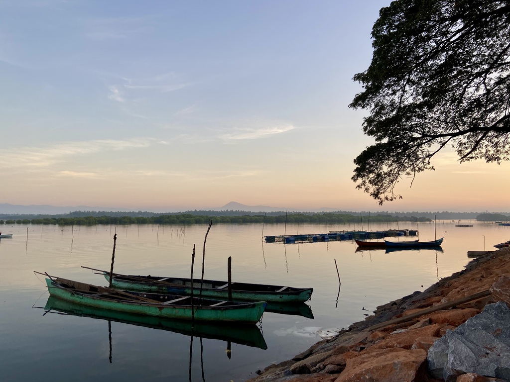
The Gangolli estuary & backwaters
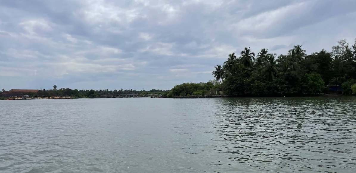
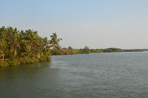
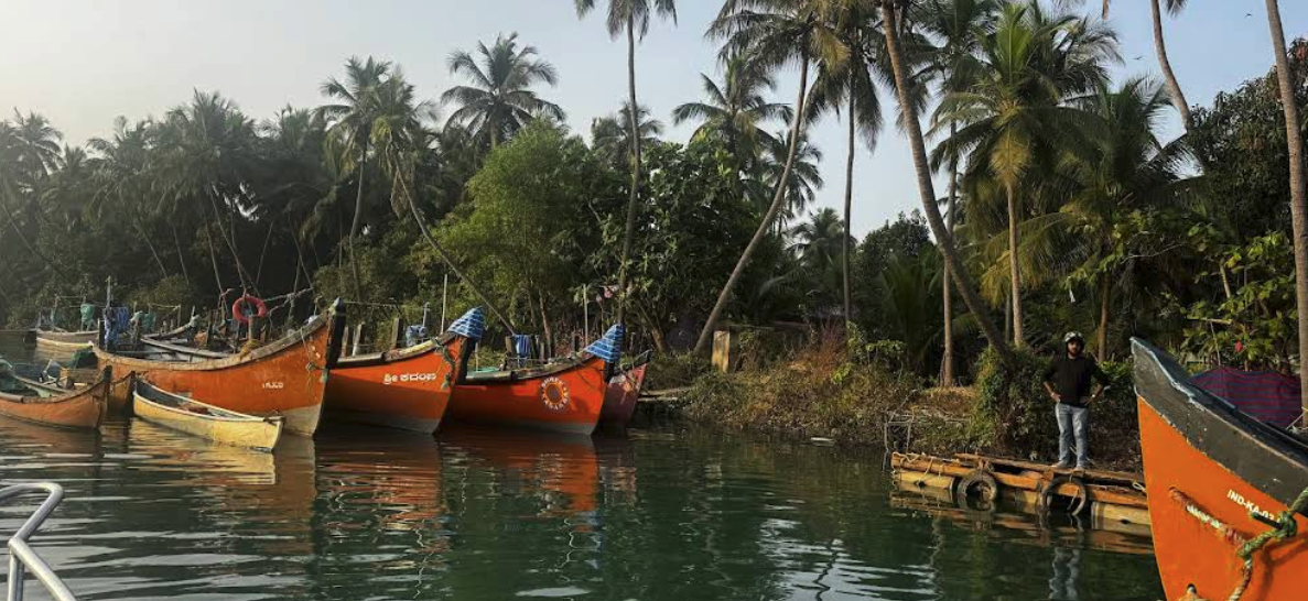
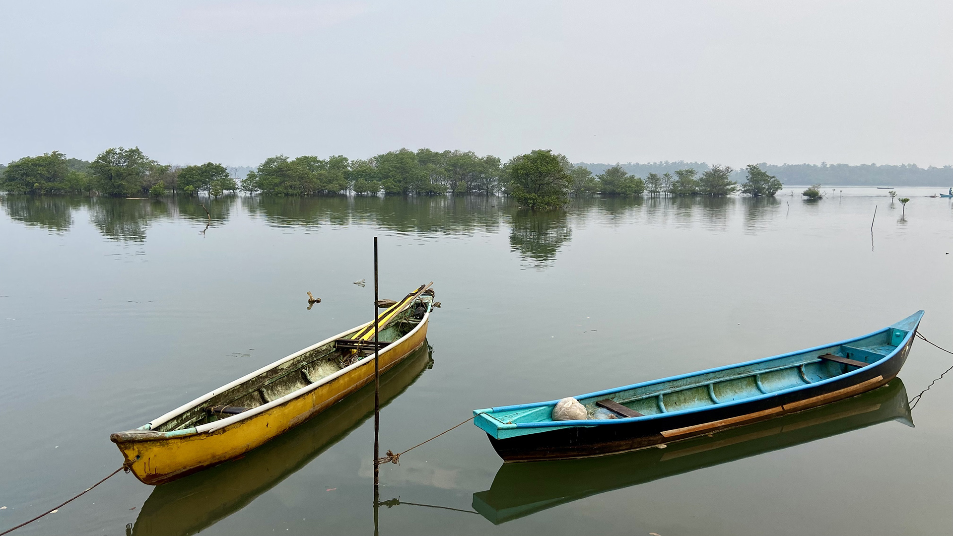
Below the confluence the rivers spread into a maze of backwaters, tidal creeks and low river-islands (locally kudru) fringed with coconut palm and mangrove. The estuary is the living heart of the system: it absorbs monsoon floods, filters sediment, moderates salinity, and shelters the fish and crustaceans on which local fisheries depend. Country boats and small ferries still thread between the islands, and dawn and dusk over the water are among the quiet glories of the coast.
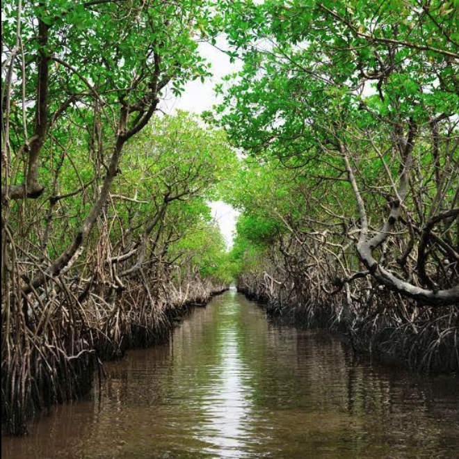
Mangroves & wildlife
The Gangolli backwater and the islands around Kodi, Uppinakudru and Kannada Kudru hold extensive mangrove forests, a recent survey counted at least nine true mangrove species, among them Rhizophora mucronata, Avicennia marina, Bruguiera and Sonneratia. Covering roughly 600 hectares as of 2021, in places they form a dense green canopy 20–25 feet high. These "living shorelines" are nurseries for fish, crab and prawn, protect farmland from salinity, and store carbon.
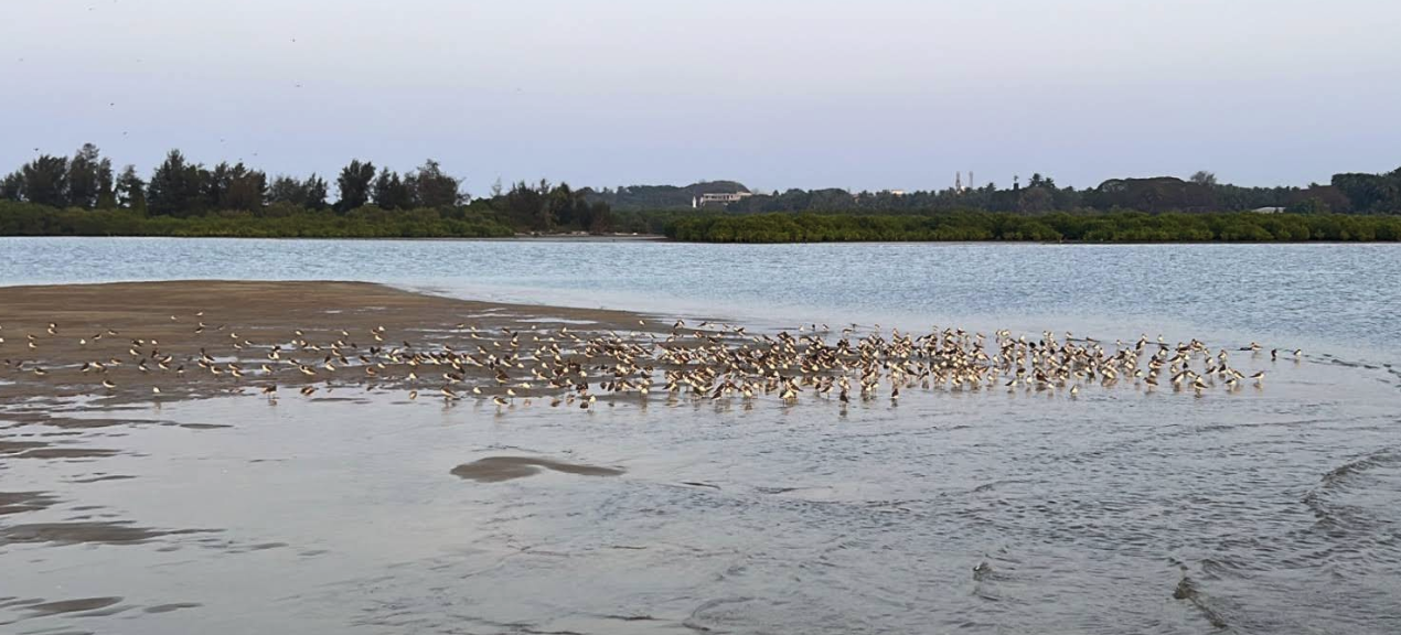
The estuary draws abundant birdlife (white-bellied sea eagles, grey herons, kingfishers and gulls feeding on the tidal flats) and the nearby open beaches at Gangolli and Kodi are nesting grounds for the olive ridley sea turtle. Guided boat tours through the mangroves, which began around 2019, have made the backwaters a growing centre of low-impact eco-tourism.
Water, power & livelihoods
The rivers serve many uses. The Varahi (Halady) is the primary drinking-water source for Kundapura town, a pumping intake commissioned in 2007 delivers around 7.6 million litres a day, replacing the town's earlier reliance on groundwater. The Varahi also hosts Karnataka's first underground hydro-electric plant (460 MW, in operation since 1989), where the Mani Dam and tunnels divert water through an underground powerhouse before returning it downstream.
Beyond that, lowland paddy along the rivers draws some irrigation, and the brackish estuary supports fisheries, pomfret, barramundi, catfish, prawns and crabs. Historically Gangolli port was a hub for trade with Gujarat and the Middle East; today commercial navigation is minimal, though the system has been notionally identified as National Waterway NW-76.
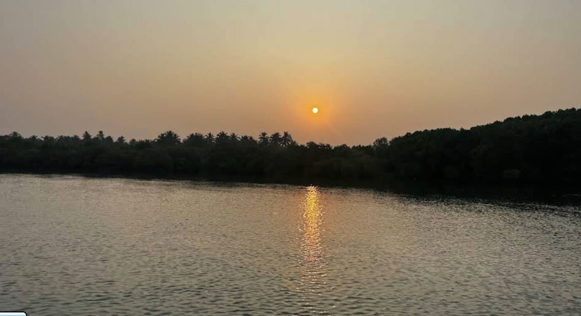
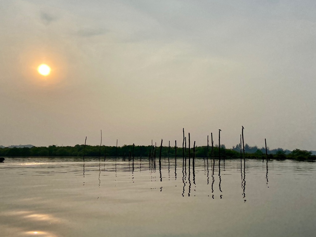 Estuary at dusk
Pressures & conservation
For all its richness, the Panchagangavalli river basin is fragile and under stress. Studies warn of "dramatic transitions" as roads, bridges and resorts fragment habitats; tidal creeks are filled to raise land, and hard coastal defences threaten the shoreline and turtle-nesting beaches. Unregulated sand mining, the subject of a 2026 Lokayukta investigation in Udupi district, undermines riverbanks and spawning grounds, while urban wastewater and farm runoff degrade water quality. Rising seas and fiercer monsoons add further risk of flooding and saltwater intrusion.
Against this, there are real successes. The Karnataka Forest Department, with community support, has planted some 450 hectares of mangroves over the past decade, making Kundapura a model for community-led restoration. Fishers' cooperatives police breeding seasons, school programmes teach mangrove ecology, and grassroots "Save Panchagangavalli" campaigns press for the river to be planned as a living whole. Sustained restoration, stricter enforcement of coastal and mining rules, and community-based monitoring are the agreed path forward.
See also
References & notes
- Compiled report: "Kundapura's Rivers, the Panchagangavalli Basin: Geography, Hydrology, Ecology & Governance" (executive summary).
- Ecological surveys of the Gangolli–Kodi mangroves (mangrove species & extent, ~600 ha, 2021).
- ADB / KUIDFC Kundapura urban water-supply project reports (Varahi intake, 7.6 MLD).
- Varahi Hydro-Electric Project (460 MW, commissioned 1989), Karnataka Power Corporation.
- Karnataka Lokayukta sand-mining probe, Udupi district (2026); coastal-zone and aquapelagic landscape studies.
Photographs were contributed by residents and visitors documenting the rivers and backwaters, and are used for educational and cultural reference, not for commercial purposes.